Coastal flood watch issued for Del Norte coast through Thanksgiving
High tides and large surf could push saltwater into low-lying areas Tuesday through Thursday, weather service says
 By Nick Maietta
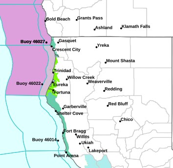
The National Weather Service in Eureka has issued a Coastal Flood Watch for coastal Del Norte County. It runs from Tuesday morning, Nov. 24, through Thursday afternoon, Nov. 26, which is Thanksgiving Day.
The weather service says high astronomical tides and large surf could cause moderate to major flooding in low-lying areas along the coast. Up to a half foot to one foot of saltwater could cover the ground in low-lying areas near shorelines and tidal waterways.
“Several coastal roads may be closed. Low lying property and some critical infrastructure will be inundated. Some shoreline erosion may occur,” the watch states.
The watch also covers southwestern Humboldt and coastal Mendocino counties.
A watch means flooding is possible but not yet imminent. The weather service advises that “coastal residents in the watch area should begin preparations for rising water and take appropriate action to protect life and property.”
When to watch the water
The weather service says the worst flooding is most likely from two hours before to two hours after each high tide. NOAA predicts these morning high tides at its Crescent City tide station:
- Tuesday, Nov. 24: 10:13 a.m., 8.4 feet. Peak window roughly 8:15 a.m. to 12:15 p.m.
- Wednesday, Nov. 25: 10:57 a.m., 8.6 feet. Peak window roughly 9 a.m. to 1 p.m.
- Thursday, Nov. 26 (Thanksgiving): 11:45 a.m., 8.5 feet. Peak window roughly 9:45 a.m. to 1:45 p.m.
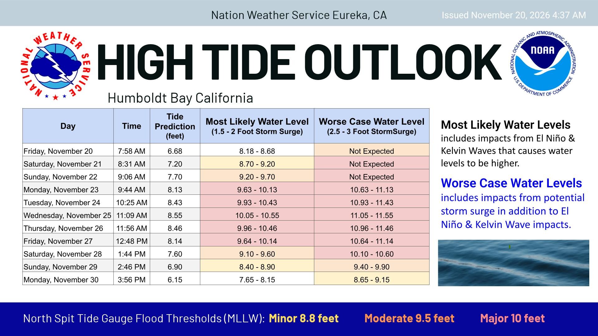
Those are tide-table predictions. Actual water levels may run higher. In a separate High Tide Outlook for Humboldt Bay, the weather service expects water levels this week to run 1.5 to 2 feet above the predicted tide in its most likely scenario. It attributes the extra height to El Niño and Kelvin wave effects. In a worst case with storm surge, levels could run 2.5 to 3 feet above the predicted tide.
Rough water offshore Saturday
A Small Craft Advisory and a Gale Warning are in effect from 1 a.m. to 9 a.m. Saturday for waters from Point St. George south to Cape Mendocino.
- Within 10 nautical miles of shore, forecasters expect south winds of 20 to 30 knots, gusts up to 35 knots and seas of 4 to 6 feet.
- From 10 to 60 nautical miles out, they expect southwest winds of 20 to 30 knots, gusts up to 40 knots and seas of 6 to 9 feet. The weather service warns these conditions “could capsize or damage vessels and reduce visibility.”
Cold mornings, rain and mountain snow
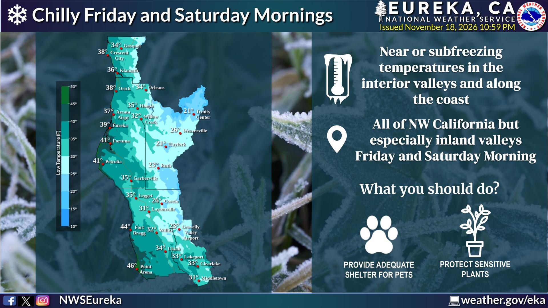
The weather service expects chilly mornings Friday and Saturday across Northwest California. Its forecast map shows lows near 38 degrees in Crescent City and 34 in Gasquet.
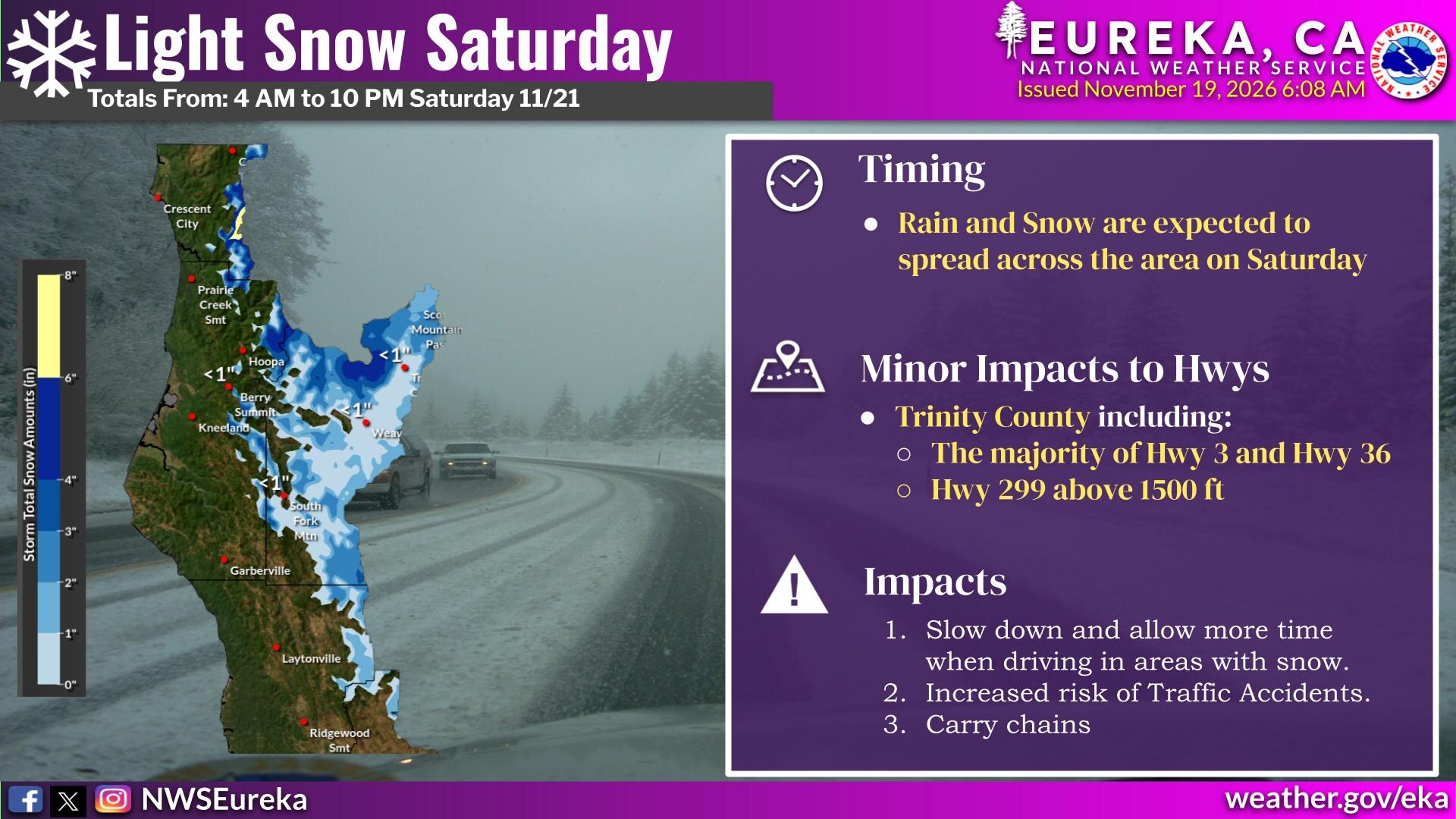
Rain and snow are expected to spread across the region Saturday. The weather service’s snowfall map shows accumulation mainly at higher elevations, including the mountains of eastern Del Norte County. The forecast highway impacts are minor and mostly in Trinity County.
For updates, visit weather.gov/eka. Tide predictions for Crescent City are on NOAA Tides & Currents (station 9419750).